Effect of Wind on Aircraft Navigation

The preceding discussion explained how to measure a TC on the aeronautical chart and how to make corrections for variation and deviation, but one important factor has not been considered—wind. Wind is a mass of air moving over the surface of the Earth in a definite direction. When the wind is blowing from the north … Read more
Latitude and Longitude for Pilot Navigation

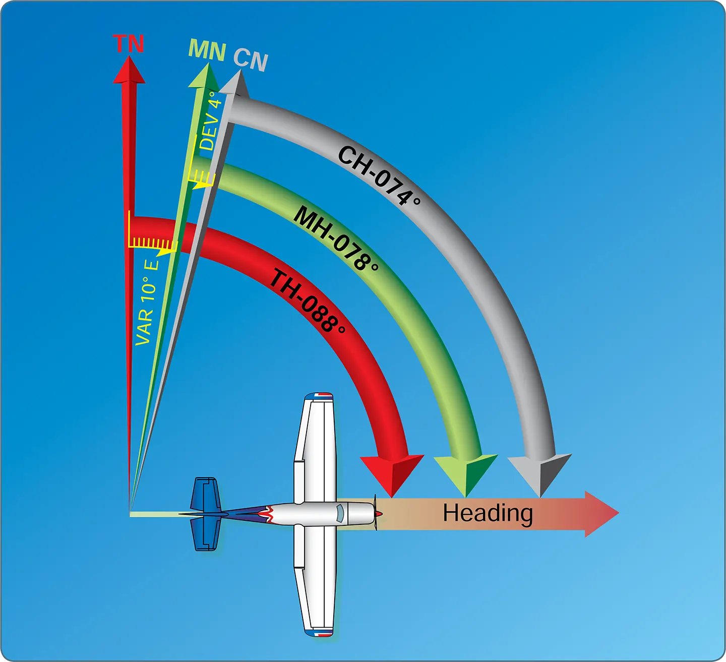
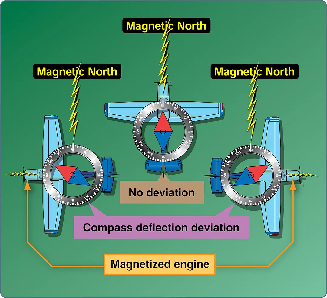
Navigation begins with understanding the Earth’s geographic reference system and how direction is measured. Pilots use latitude and longitude to identify locations, time zones to coordinate flight operations, and directional references to plan and maintain accurate flight paths. Because aircraft navigation relies on both geographic and magnetic references, pilots must also understand concepts such as … Read more

Aeronautical Charts Explained for VFR Pilots

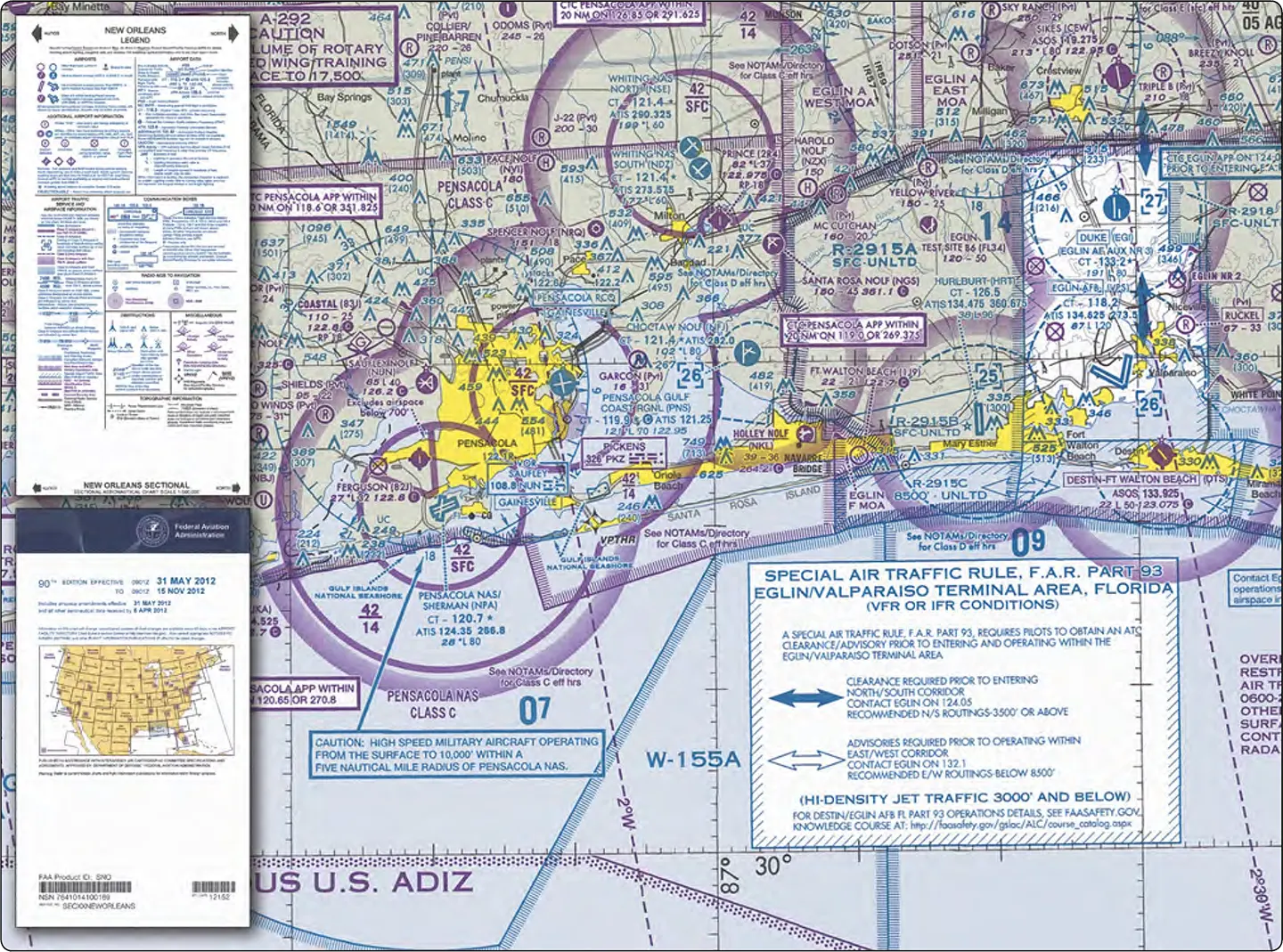
Aeronautical charts are the primary navigation reference for pilots operating under Visual Flight Rules (VFR). Much like a road map for motorists, these charts provide essential information that helps pilots determine their position, plan routes, identify landmarks, avoid hazards, and navigate safely from departure to destination. In addition to airports and navigational aids, aeronautical charts … Read more

Navigation

This section provides an introduction to cross-country flying under visual flight rules (VFR). It contains practical information for planning and executing cross-country flights for the beginning pilot. Air navigation is the process of piloting an aircraft from one geographic position to another while monitoring one’s position as the flight progresses. It introduces the need for … Read more

Lost Procedures and Flight Diversion

Lost Procedures Getting lost in flight is a potentially dangerous situation, especially when low on fuel. If a pilot becomes lost, there are some good common sense procedures to follow. If a town or city cannot be seen, the first thing to do is climb, being mindful of traffic and weather conditions. An increase in … Read more

Ground-Based Navigation (Part 2)

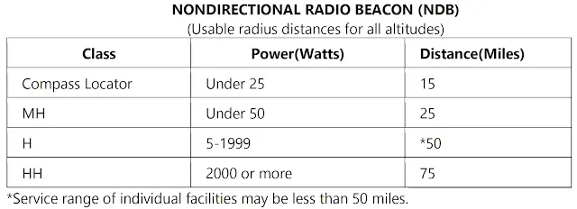
Automatic Direction Finder (ADF) Many general aviation-type aircraft are equipped with ADF radio receiving equipment. To navigate using the ADF, the pilot tunes the receiving equipment to a ground station known as a nondirectional radio beacon (NDB). The NDB stations normally operate in a low or medium frequency band of 200 to 415 kHz. The … Read more

Ground-Based Navigation (Part 1)

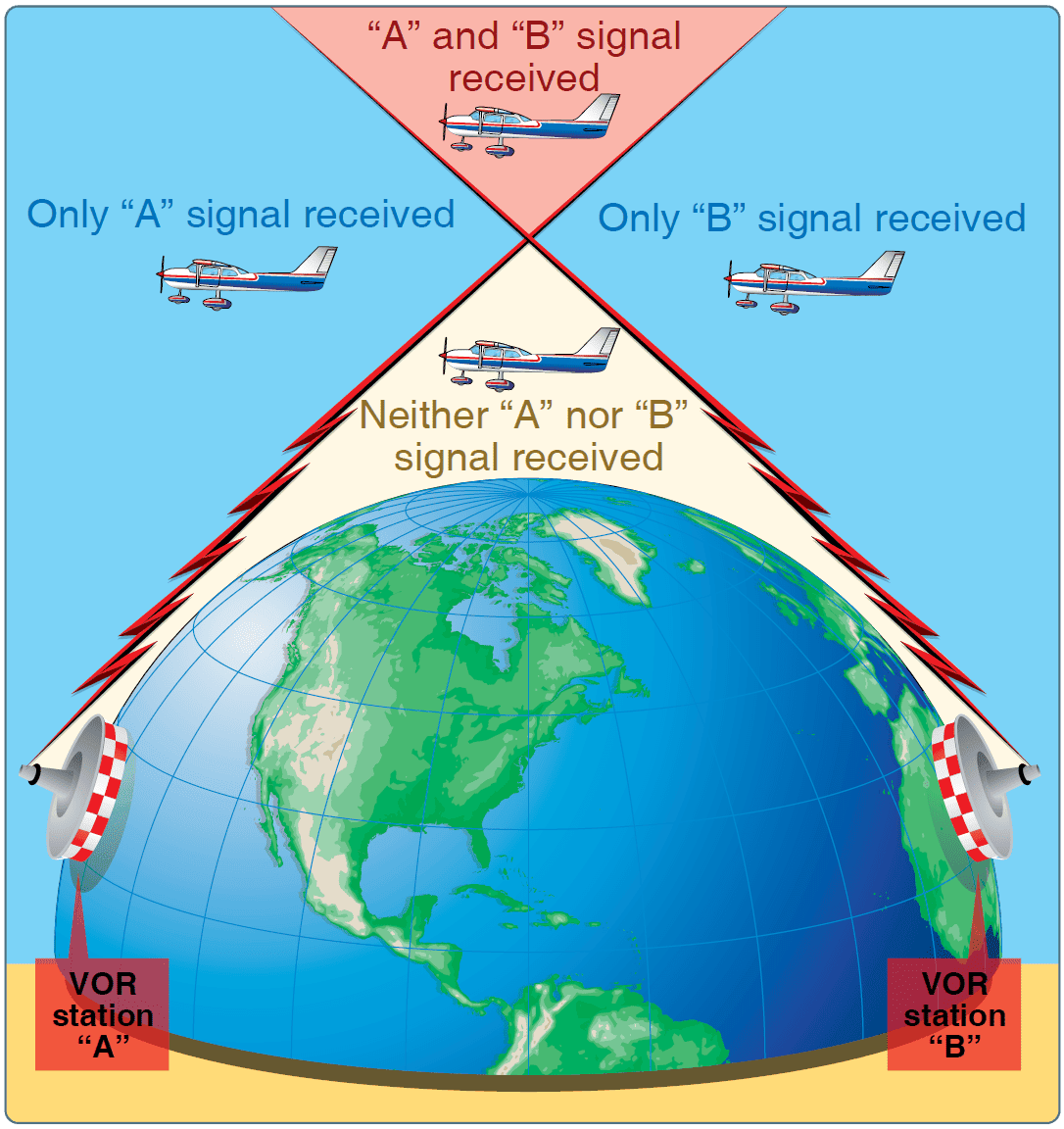
Advances in navigational radio receivers installed in aircraft, the development of aeronautical charts that show the exact location of ground transmitting stations and their frequencies, along with refined flight deck instrumentation make it possible for pilots to navigate with precision to almost any point desired. Although precision in navigation is obtainable through the proper use … Read more

Filing a VFR Flight Plan

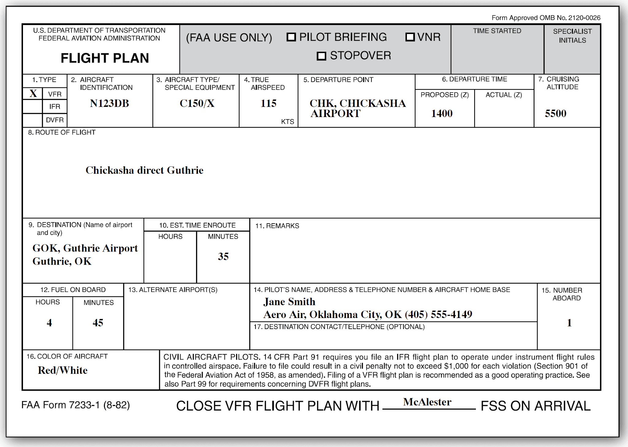
Filing a flight plan is not required by regulations; however, it is a good operating practice since the information contained in the flight plan can be used in search and rescue in the event of an emergency. Flight plans can be filed in the air by radio, but it is best to file a flight … Read more

Charting the Course

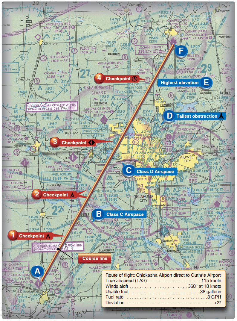
Once the weather has been checked and some preliminary planning completed, it is time to chart the course and determine the data needed to accomplish the flight. The following sections provide a logical sequence to follow in charting the course, complete a flight log, and filing a flight plan. In the following example, a trip … Read more

Flight Planning

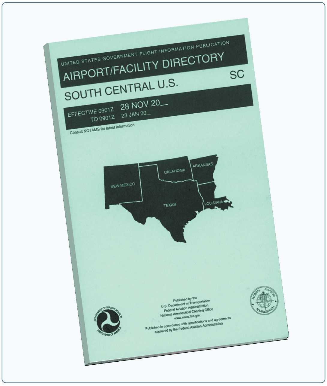
Title 14 of the Code of Federal Regulations (14 CFR) part 91 states, in part, that before beginning a flight, the pilot in command (PIC) of an aircraft shall become familiar with all available information concerning that flight. For flights not in the vicinity of an airport, this must include information on available current weather … Read more