Load Factor in Instrument Flight

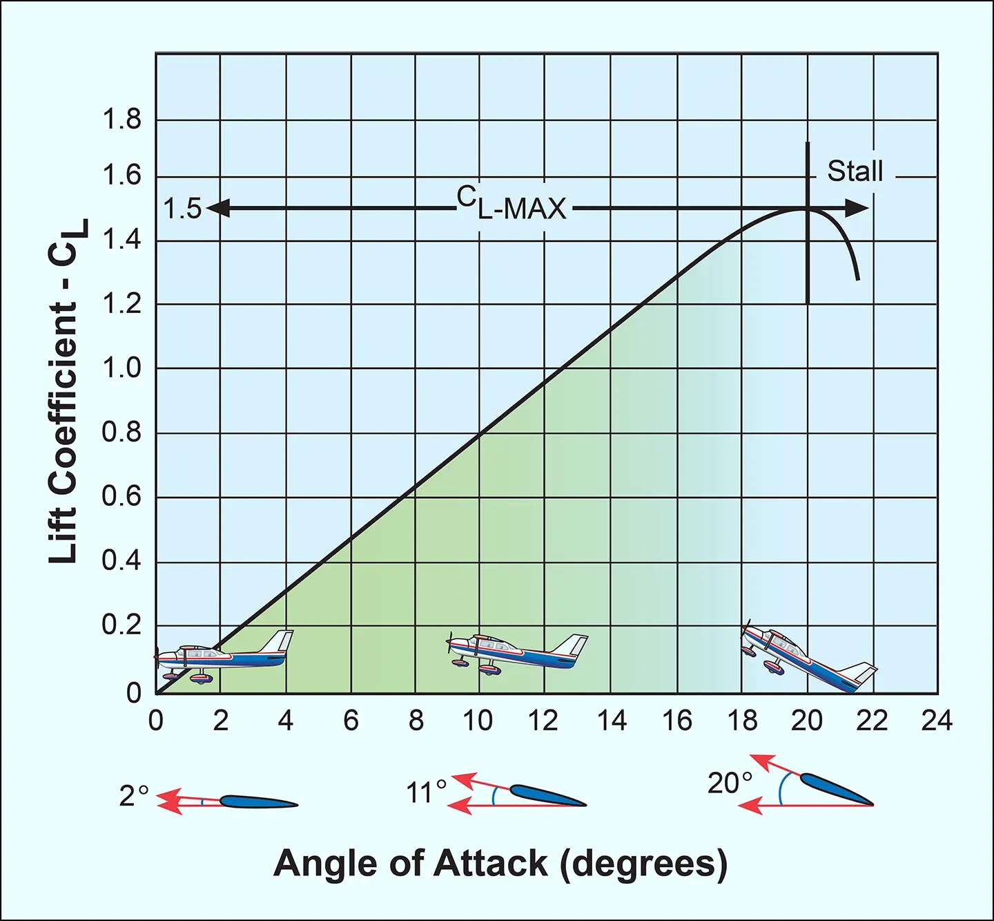
Understanding load factor is essential for instrument and visual flight, as it affects aircraft performance, stall behavior, and structural limits. In turns, turbulence, or when performing maneuvers, the aircraft experiences forces beyond its weight, and pilots must recognize how these forces influence handling and safety. Proper knowledge of load factor ensures pilots maintain safe flight … Read more
12 12

Slow-Speed Flight Under IFR

Slow-speed flight under instrument conditions demands precise control of pitch, power, and configuration. Unlike visual flight where external references assist the pilot, instrument flying requires a clear understanding of aerodynamic principles to safely operate near stall speed or in the region of reverse command. During approaches, go-arounds, and maneuvering at reduced airspeeds, the aircraft becomes … Read more

9 9

The Drag Curve

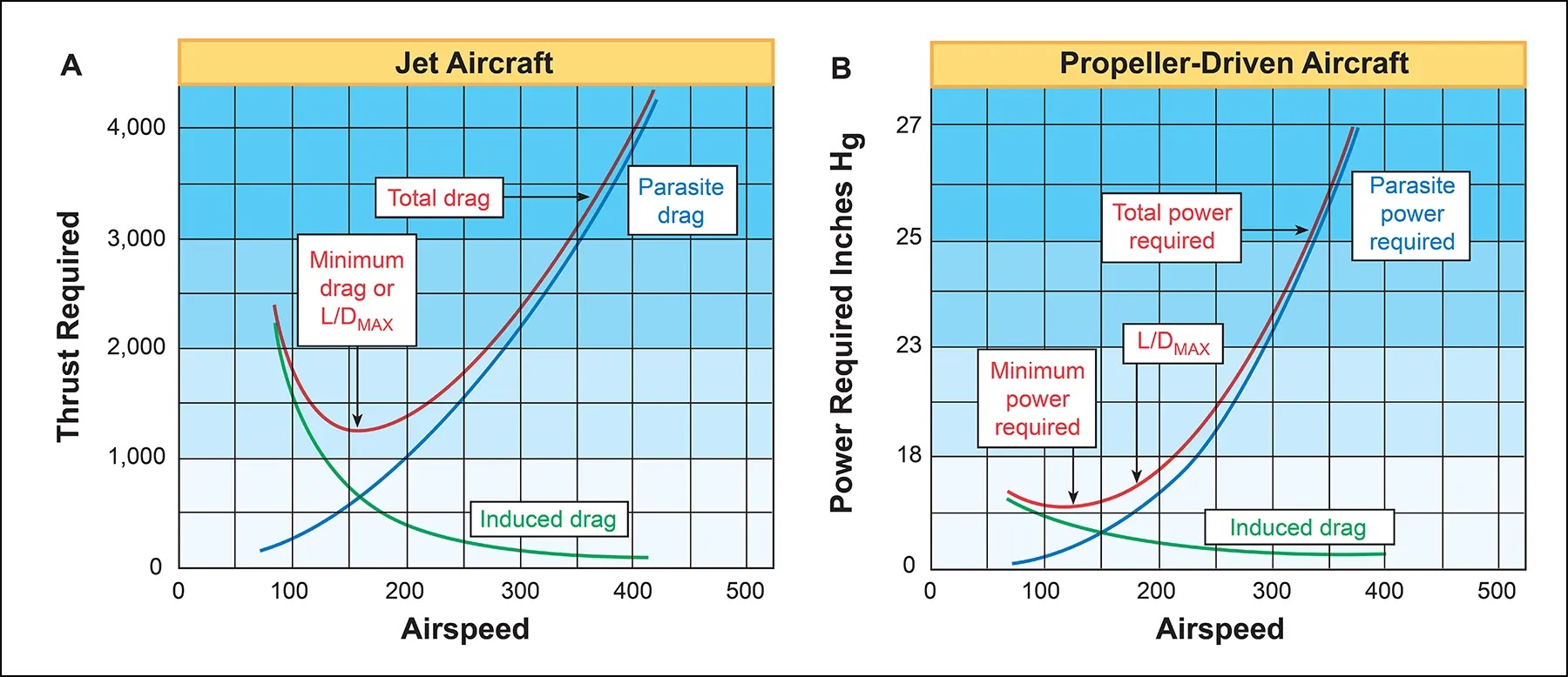
When the effects of parasite drag and induced drag are plotted against airspeed, the resulting line is called the drag curve. Parasite drag increases as airspeed increases because airflow resistance over the aircraft surfaces becomes greater. Induced drag behaves in the opposite manner; it increases as airspeed decreases because a higher angle of attack is … Read more

8 8

Lift in Instrument Flight

Lift always acts in a direction perpendicular to the relative wind and to the lateral axis of the aircraft. The fact that lift is referenced to the wing, not to the Earth’s surface, is the source of many errors in learning flight control. Lift is not always “up.” Its direction relative to the Earth’s surface … Read more

6 6 scaled

IFR Flight Services and ATC Control Facilities

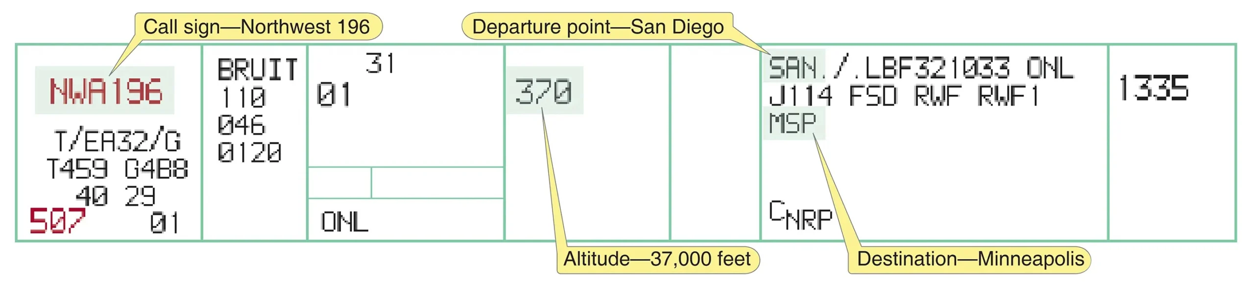
The controller’s primary responsibility is separation of aircraft operating under IFR. This is accomplished with ATC facilities, to include the FSS, airport traffic control tower (ATCT), terminal radar approach control (TRACON), and air route traffic control center (ARTCC). Flight Service Stations (FSS) A pilot’s first contact with ATC is usually through FSS, either by radio … Read more

1 1 2

ATC Communication Equipment and Procedures

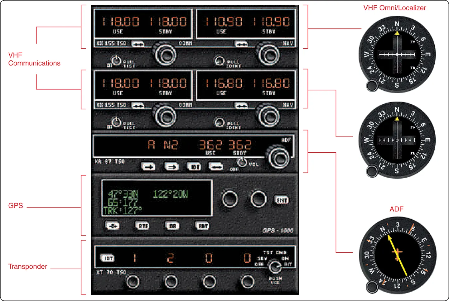
Communication Equipment Navigation/Communication Equipment Civilian pilots communicate with ATC on frequencies in the very high frequency (VHF) range between 118.000 and 136.975 MHz. To derive full benefit from the ATC system, radios capable of 25 kHz spacing are required (e.g., 134.500, 134.575, 134.600). If ATC assigns a frequency that cannot be selected, ask for an … Read more

1 8 1

Terminal Procedures Publications

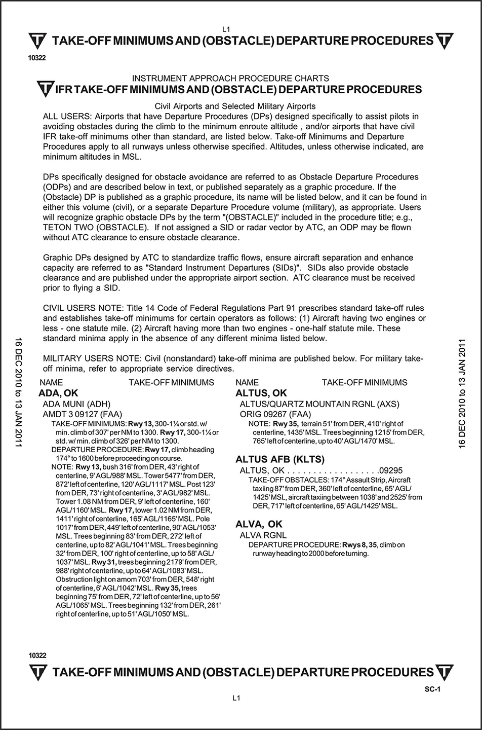
While en route charts provide the information necessary to safely transit broad regions of airspace, the United States Terminal Procedures Publication (TPP) enables pilots to safely and efficiently operate in the terminal environment, where traffic density and workload are highest. Whether departing or arriving, these standardized procedures help ensure obstacle clearance, traffic separation, and predictable … Read more

6 1

New Technologies in the National Airspace System

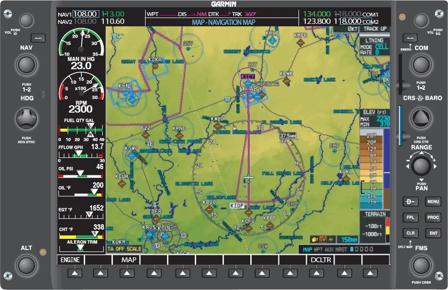
Technological advancements in avionics have significantly enhanced the efficiency, safety, and capacity of the National Airspace System (NAS). One of the most notable developments is the widespread adoption of multifunction displays (MFDs) and moving map technology in modern aircraft. Even many older aircraft are now being retrofitted with “glass cockpit” systems (Figure 1). Moving maps … Read more

3

IFR En Route Charts

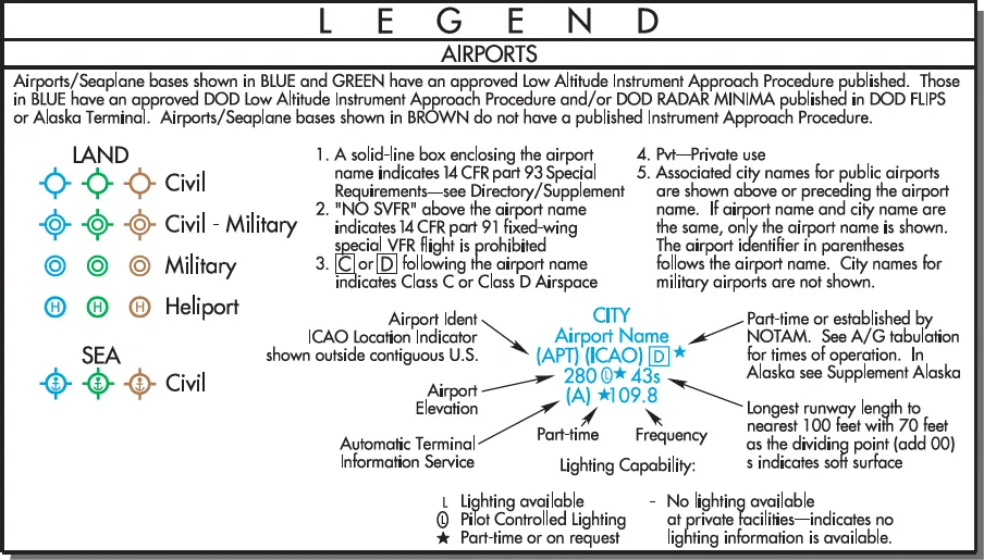
The objective of IFR en route flight is to navigate within the lateral limits of a designated airway at an altitude consistent with the ATC clearance. Your ability to fly instruments safely and competently in the system is greatly enhanced by understanding the vast array of data available to the pilot on instrument charts. AeroNav … Read more

1 4

Introduction to The National Airspace System

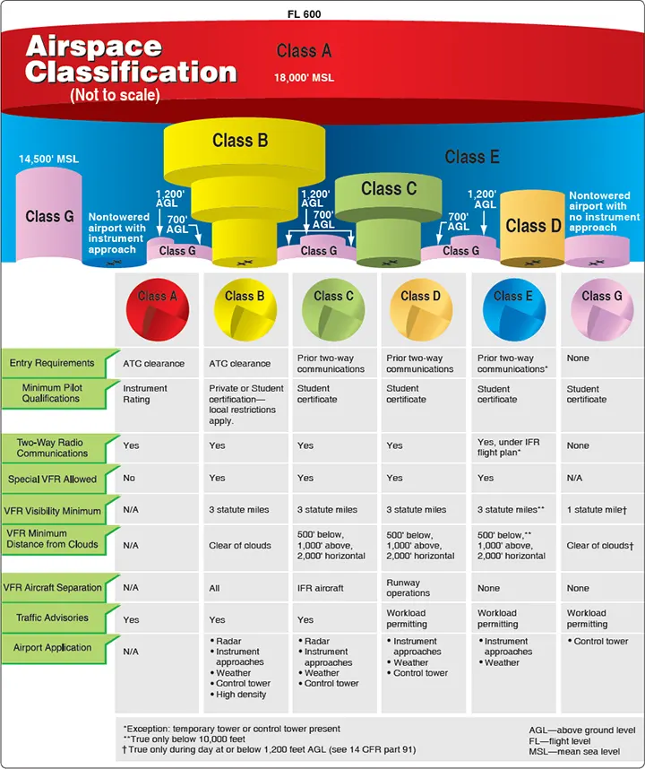
Airspace Classification Airspace in the United States [Figure 1] is designated as follows: 1. Class A. Generally, airspace from 18,000 feet mean sea level (MSL) up to and including flight level (FL) 600, including the airspace overlying the waters within 12 nautical miles (NM) of the coast of the 48 contiguous states and Alaska. Unless … Read more