Beginning in February 2000, the FAA began issuing the current format for instrument approach charts. This chart was developed by the Department of Transportation (DOT), Volpe National Transportation Systems Center and is commonly referred to as the Pilot Briefing Information format. The FAA chart format is presented in a logical order, facilitating pilot briefing of the procedures. [Figure 1]
 |
| Figure 1. Instrument approach chart |
Approach Chart Naming Conventions
Individual FAA charts are identified on both the top and bottom of the page by their procedure name (based on the NAVAIDs required for the final approach), runway served, and airport location. The identifier for the airport is also listed immediately after the airport name. [Figure 2]
 |
| Figure 2. Procedure identification |
There are several types of approach procedures that may cause some confusion for flight crews unfamiliar with the naming conventions. Although specific information about each type of approach is covered in Instrument Approaches section, listed below are a few procedure names that can cause confusion.
Straight-In Procedures
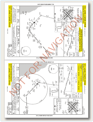
When two or more straight-in approaches with the same type of guidance exist for a runway, a letter suffix is added to the title of the approach so that it can be more easily identified. These approach charts start with the letter Z and continue in reverse alphabetical order. For example, consider the (RNAV) (GPS) Z RWY 13C and RNAV (RNP) Y RWY 13C approaches at Chicago Midway International Airport. [Figure 3] Although these two approaches can be flown with a global positioning system (GPS) to the same runway, they are significantly different (e.g., one is a Required Navigation Performance (RNP) Authorization Required (AR) formally known as SPECIAL AIRCRAFT & AIRCREW AUTHORIZATION REQUIRED (SAAAR);” one has circling minimums and the other does not; the minimums are different; and the missed approaches are not the same). The approach procedure labeled Z has lower landing minimums than Y (some older charts may not reflect this).
 |
| Figure 3. Multiple approaches |
In this example, the LNAV MDA for the RNAV (GPS) Z RWY 13C has the lowest minimums of either approach due to the differences in the final approach required obstacle clearance (ROC) evaluation. This convention also eliminates any confusion with approach procedures labeled A and B, where only circling minimums are published. The designation of two area navigation (RNAV) procedures to the same runway can occur when it is desirable to accommodate panel mounted GPS receivers and flight management systems (FMSs), both with and without vertical navigation (VNAV). It is also important to note that only one of each type of approach for a runway, including ILS, VHF omnidirectional range (VOR), and non-directional beacon (NDB) can be coded into a database.
Circling-Only Procedures
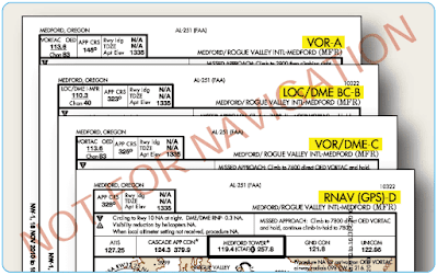
Approaches that do not have straight-in landing minimums are identified by the type of approach followed by a letter. Examples in Figure 4 show four procedure titles at the same airport that have only circling minimums.
 |
| Figure 4. Procedures with circling landing minima |
- The final approach course alignment with the runway centerline exceeds 30°.
- The descent gradient is greater than 400 ft/NM from the FAF to the threshold crossing height (TCH). When this maximum gradient is exceeded, the circling only approach procedure may be designed to meet the gradient criteria limits. This does not preclude a straight-in landing if a normal descent and landing can be made in accordance with the applicable CFRs.
- A runway is not clearly defined on the airfield.
